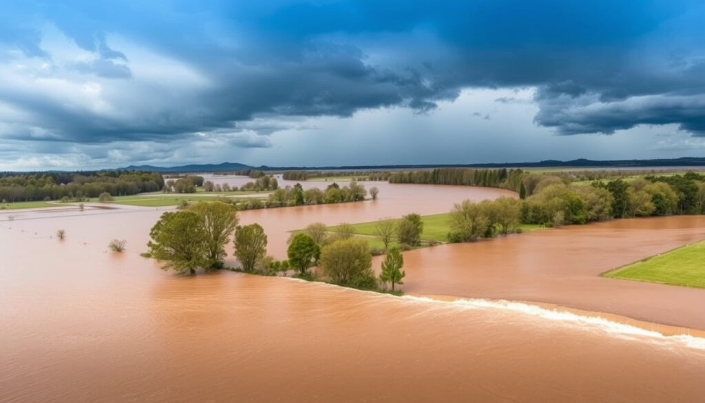
Flood Situation Near Waikato River: Live Updates & Maps
When the Waikato River rises, it’s not just nature doing its thing — sometimes it’s a deliberate move. Mercury Energy, the utility that operates hydroelectric dams along the river, intentionally increases water flow ahead of heavy rain to make room for stormwater, meaning the flood situation near the Waikato River is a mix of weather forecast and human decision.
Large rivers in Waikato region: 20 ·
Small river systems in Waikato region: ~1,400 ·
Intentional water flow increase date: July 1, 2025 ·
Flood frequency: Frequent
Quick snapshot
- Waikato region has 20 large rivers and ~1,400 small river systems prone to flooding (Waikato Regional Council (regional government authority)).
- Mercury Energy increased water flow on July 1, 2025 ahead of forecast heavy rainfall (RNZ (New Zealand public broadcaster)).
- The Waikato Regional Hazards Portal provides live river flooding data (Waikato Regional Hazards Portal (live mapping tool)).
- Exact flood levels in specific areas.
- Duration of current flooding.
- Number of affected properties.
- Exact peak water levels at specific locations downstream.
- Timing of when rivers will return to normal levels.
- Water levels downstream of Ngāruawāhia may peak later today (RNZ).
- Hamilton City Council closed river paths for safety (RNZ).
Four key facts about the flood situation, one pattern: the Waikato River system is managed intensively, but the region’s sheer number of waterways makes widespread flooding a constant risk.
| Label | Value |
|---|---|
| Number of large rivers | 20 |
| Number of small river systems | ~1,400 |
| Recent water flow increase | July 1, 2025 by Mercury Energy |
| Live monitoring portal | Waikato Regional Hazards Portal v3.0 |
The implication: with so many small catchments, localized flooding can happen even when the main river is controlled.
Flood Situation Near Waikato River: Updates and Resources
Does the Waikato River flood?
Yes, and often. The Waikato region is home to 20 large rivers and about 1,400 small river systems, all of which are prone to flooding (Waikato Regional Council (regional government authority)). The Waikato River itself is the longest river in New Zealand, and its flow is heavily modified by hydroelectric dams operated by Mercury Energy. That combination — natural rainfall plus controlled releases — creates a unique flood risk that residents and authorities have to watch carefully.
What are the main causes of flooding along the Waikato River?
- Heavy rainfall over saturated catchments — the region’s soils can’t absorb more water, so it runs straight into rivers (RNZ (New Zealand public broadcaster)).
- Intentional water releases from hydro dams — Mercury Energy increases flow through the Waikato River ahead of heavy rain to create extra capacity in the hydro system.
- Tributary flooding — smaller rivers like the Waipā and Mangawara can rise quickly and back up into the main river.
What this means: flood risk comes from both the sky and the tap. A sunny day can still bring rising water if Mercury has opened the gates upstream.
How frequently does the Waikato River flood?
Flooding is frequent in the Waikato region (NIWA (climate research institute)). The council’s Flood Room notes that streams and rivers can remain above expected normal levels for 36–48 hours after recent rainfall (Waikato Regional Council). Historical data shows that major floods occur every few years, with the most recent significant events in 2023 and 2025.
The Waikato River isn’t a flood-once-a-century river. It’s a flood-every-year river, but the degree varies. The real risk is when a controlled release coincides with a heavy rain event — then the river can overwhelm its banks quickly.
What is the current flood situation near the Waikato River today?
As of early July 2025, the Waikato River is experiencing elevated levels due to a combination of recent heavy rainfall and a deliberate water release from the Karāpiro Dam. Mercury Energy increased the flow on July 1, 2025, and the release was expected to continue until Wednesday evening, July 2.
Where can I find live flood warnings for the Waikato River?
The most authoritative source is the Waikato Regional Hazards Portal (live mapping tool), which provides real-time river levels, flows, and rainfall accumulations. The council’s dedicated Flood Room page is currently deactivated and directs users to the Environmental Data Hub for current data.
Are there any active flood warnings in the Waikato region right now?
Yes. The Waikato Regional Council has warned that saturated catchments across parts of the region increase the risk of surface flooding, elevated river levels, and land instability if further rain falls. Hamilton City Council closed several river paths for safety: Awatere Avenue to Ann Street, Te Hikuwai Reserve, the path below Memorial Park, and Pine Beach to Fairfield Esplanade.
Water levels in the Waipā and Waikato rivers downstream of Ngāruawāhia may peak later today. If you live near those stretches, check the portal before making travel plans.
How can I monitor river flooding in the Waikato region?
There are two main tools: the online hazard portal and dedicated phone information lines. Knowing how to use them can turn a vague worry into a specific, actionable plan.
What is the Waikato Regional Hazards Portal?
It’s a web-based mapping tool that shows current river levels, flows, and rainfall data across the entire Waikato region. You can access it at the Waikato Regional Hazards Portal. The portal is updated in real time and is the quickest way to see if your local river is rising.
How to use the live flood map for the Waikato region?
- Open the portal and zoom into your area of interest.
- Click on any monitoring station icon to see the current water level, flow rate, and trend.
- Compare the current level against the flood warning threshold (marked in orange or red).
- Bookmark the page on your phone for quick access during a storm.
Additionally, the council provides monitored-site information lines for different catchments: WAIPA/LOWER WAIKATO/LAKE WAIKARE/MANGARAWA at 0832 25336, and TAUPO BASIN/AWAKINO at 0832 25337 (Waikato Regional Council brochure (civil defence guidance)).
The portal is only useful if you check it before the rain intensifies. Once the storm hits, roads may flood and you won’t be able to get to higher ground. Set a weather alert on your phone for the Waikato region.
Timeline of recent events
- Late June 2025: Heavy rainfall affected communities in Waitomo and Waikato, causing rising water levels.
- July 1, 2025: Mercury Energy intentionally increased water flow through the Waikato River ahead of further heavy rainfall. The Karāpiro Dam started releasing water late Monday; the release was expected to continue until Wednesday evening, July 2.
- July 2, 2025: Water levels downstream of Ngāruawāhia were expected to peak. Hamilton City Council closed several river paths.
The trade-off: controlled releases reduce the risk of a catastrophic dam failure but increase the frequency of moderate flooding downstream. Residents near the river have to treat a “normal” high flow with the same caution as a natural flood.
Clarity: What we know and what we don’t
Confirmed facts
- Waikato River floods frequently (Waikato Regional Council).
- Waikato region has 20 large rivers and 1,400 small river systems.
- Mercury Energy increased water flow on July 1, 2025.
- Waikato Regional Hazards Portal provides live river flooding data.
- Hamilton City Council closed specific river paths for safety.
What’s unclear
- Exact flood levels in specific areas — the portal shows station data, not street-level depth.
- Duration of current flooding — rivers may stay high for 36–48 hours.
- Number of affected properties — no official tally has been released.
- Exact peak water levels at specific locations downstream.
- Timing of when rivers will return to normal levels.
“Heads-up that water level of the Waikato River will be intentionally increased, possibly causing temporary flooding at Grantham Street.”
— Waikato Regional Council, via Facebook post (Waikato Regional Council Facebook (community update))
Mercury Energy increased the Waikato River’s water flow ahead of expected heavy rainfall to create extra capacity in the hydroelectric system.
— Mercury Energy, as reported by RNZ (New Zealand public broadcaster)
For residents near the Waikato River, the choice is clear: monitor the hazard portal daily during wet weather, prepare an evacuation plan, and treat controlled releases as seriously as natural floods. The alternative — waiting until the water is at your doorstep — is a gamble no one should take.
youtube.com, waikatoregion.govt.nz, waikatoregion.govt.nz, youtube.com, waikatoregion.govt.nz
Frequently asked questions
How do I check if my property is at risk of flooding from the Waikato River?
Use the Waikato Regional Hazards Portal to view current river levels near your property. You can also check the council’s flood hazard maps (available on their website) to see whether your address is in a designated flood zone.
What should I do if I see rising water levels?
Move to higher ground immediately. Do not drive or walk through floodwater — it may be deeper or faster than it looks. Call the Waikato Regional Council’s 24-hour flood line (0800 800 401) or check the portal for official warnings. Follow National Emergency Management Agency (Civil Defence) guidance.
How does Mercury Energy manage the river flow?
Mercury Energy operates hydroelectric dams along the Waikato River. During heavy rain, they increase the flow through the dams — releasing water from reservoirs — to create extra capacity and prevent overtopping. This is done under a High Flow Management Plan in coordination with the Waikato Regional Council.
Are there any flood watches currently in effect for the Waikato region?
As of early July 2025, the council’s Flood Room is deactivated, but the Environmental Data Hub shows elevated river levels downstream of the Karāpiro Dam. Check MetService (national weather service) for active weather warnings.
Where can I get sandbags in Hamilton?
Contact the Hamilton City Council civil defence team (07 838 6699) or check the Waikato Regional Council website for sandbag distribution points during an active flood event.
What is the flood history of the Waikato River?
The Waikato River has a long history of flooding, with major events in 1998, 2004, 2017, and 2023. The frequency is increasing due to climate change and land-use changes (NIWA (climate research institute)).
How does the Waikato Regional Council forecast floods?
The council uses a network of river gauges, rainfall data from NIWA, and weather forecasts from MetService. When rivers are predicted to reach warning levels, they activate the Flood Room and issue alerts via their website, social media, and phone information lines.
More related posts
 Old Death Notices Christchurch: How to Find Obituaries
 Compare Home Insurance NZ 2024: Best Rates & Providers
 When Does Daylight Savings End? Ireland 2026 Dates & Tips
 Miracle on 34th Street: Story, Oscars & Real Store
 All Blacks vs Scotland 2026: how to watch & history
 Dodgers vs Milwaukee Brewers Match Player Stats – Box Score & Top Performers
 Best Unlimited Mobile Plans in Ireland: Compare 2025 Deals
 Newcastle United F.C.: History, Ownership, Players, Key Facts
